LMT BIMS is a situational awareness application developed for the Latvian National Armed Forces and other state security services. It enables real-time mission oversight, faster decision-making, and effective crisis management by connecting multiple agencies in one digital environment. The system reduces the “fog of war”, improves communication between institutions, and positions LMT as a trusted partner in defense and civil protection.
Feature overviev
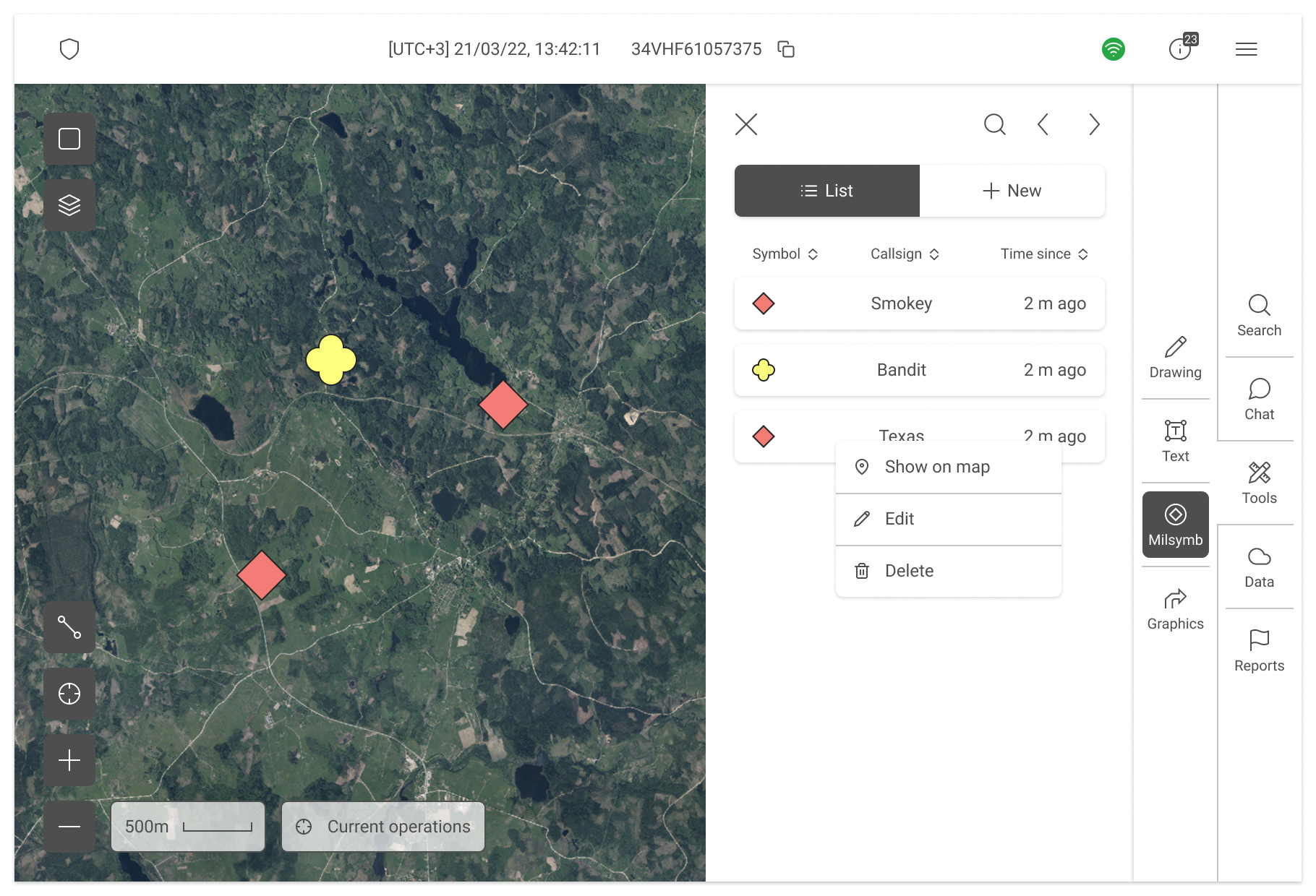
MILSYMB is the feature in LMT BIMS that lets users place NATO-standard military symbols on the map. These symbols encode structured meaning - like unit identity, size, or hostility - and are essential for both planning and live missions. The main challenge was balancing strict compliance with the NATO 2525 standard against the need for speed and simplicity in the field. The feature ultimately had to support two very different workflows: planners creating detailed unit layouts in advance, and operators in the field quickly tagging enemies or incidents to share instantly with teammates.
Stage 1 - full compliance, low usability
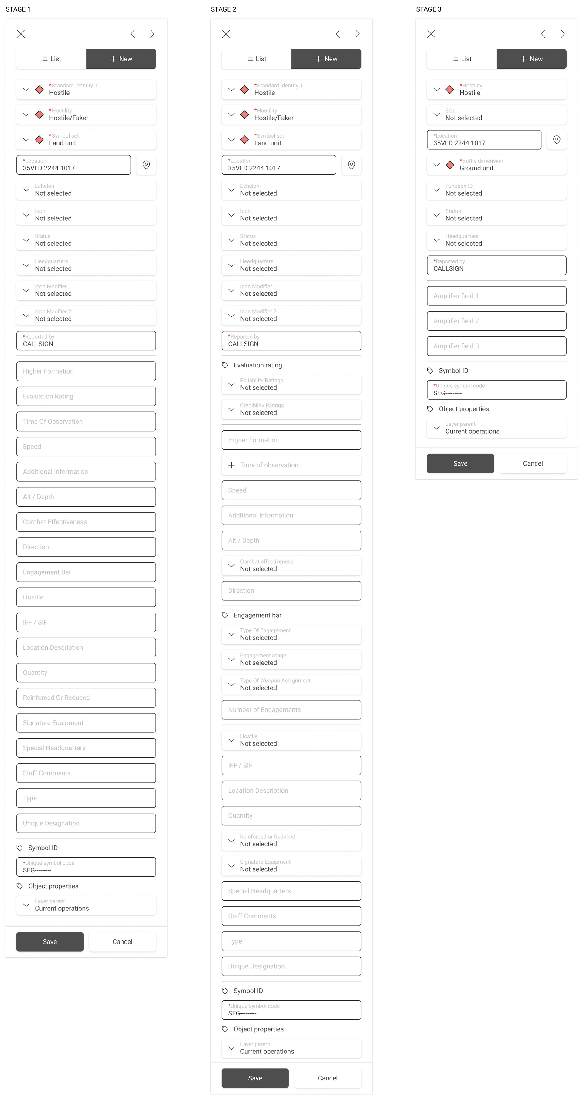
The first version exposed almost the entire NATO field catalog in one long form. Every attribute - from unit echelon to combat effectiveness - appeared as an open text field. While this met the technical requirement of compliance, it was practically unusable. Most users didn’t know the specific input codes for every attribute, and filling them in manually was slow and error-prone. Placing a single symbol could take minutes, and many users avoided the feature unless absolutely necessary.
Stage 2 - input simplification
User feedback quickly showed the need for faster, more guided inputs. In the next iteration, many of the raw text fields were replaced with dropdowns and predefined values. This meant users no longer had to remember obscure codes or type everything manually. By surfacing the most common symbol attributes in a structured way, symbol creation became much quicker and less error-prone. This was a turning point: the tool shifted from being technically correct but impractical, to something that could realistically be used in everyday workflows.
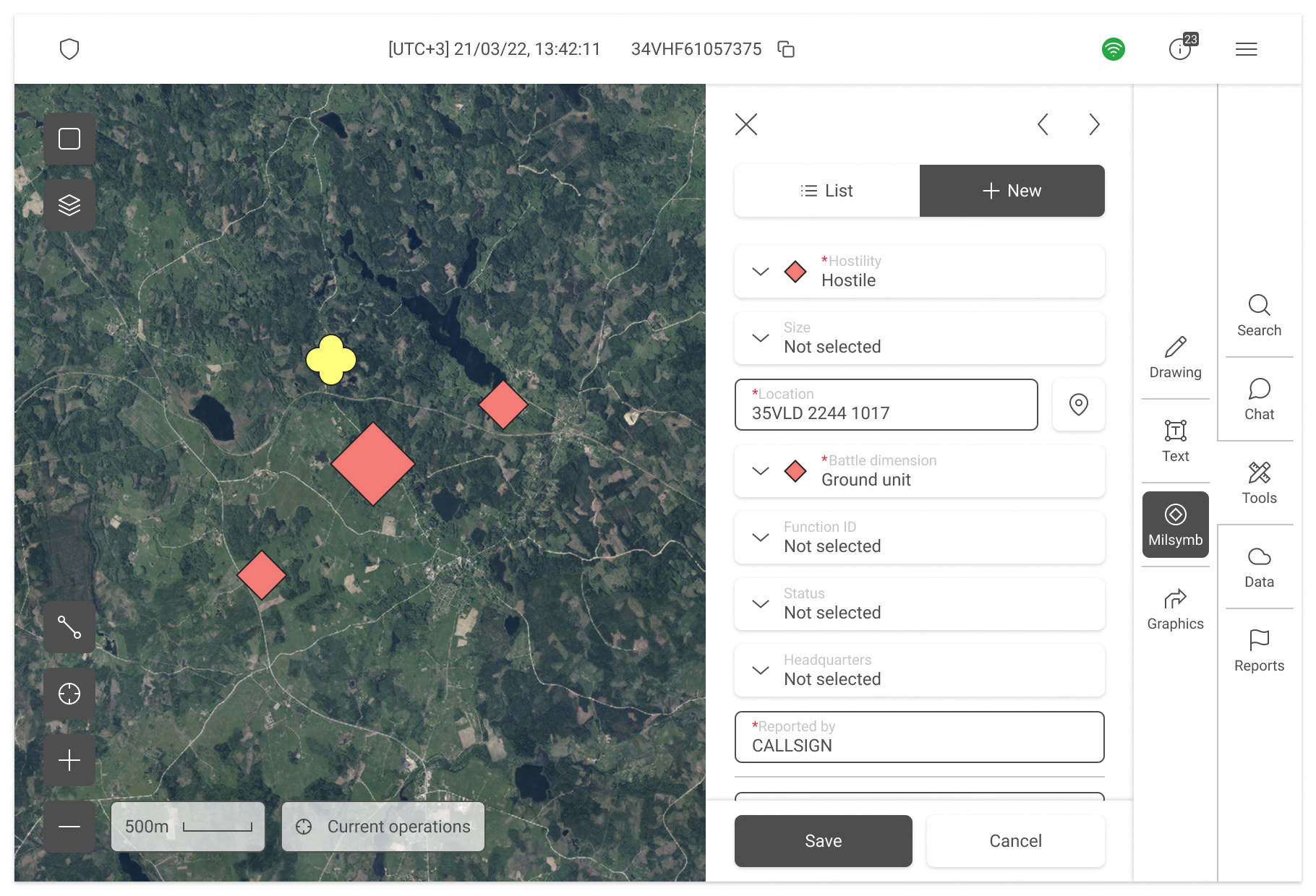
Stage 3 - admin-controlled complexity
Once the tool became more usable, the next problem was information overload. Not every mission needed the full catalog of fields, and frontline users complained about too much complexity. To solve this, we introduced admin controls - mission administrators could toggle which fields were available for each mission, tailoring the interface to the mission context. In a planning scenario, where full detail was needed, all fields could be kept visible. In fast-paced field operations, admins could hide everything except the essentials, allowing soldiers to drop symbols with just a few key attributes. This flexibility allowed MILSYMB to adapt to both mission planning and live reporting use cases without sacrificing compliance.
Impact on metrics
The redesign had clear measurable benefits. Average time to place a basic symbol dropped from 2 - 3 minutes in Stage 1 to under 45 seconds in Stage 3. A generic enemy symbol could be dropped on the map and automatically shared with the team in just 3 clicks. With dropdowns guiding inputs, input errors for more complex unit symbols decreased by around 35%, since users no longer guessed codes or mis-typed values. Onboarding improved dramatically: new users could learn the basics in under 30 minutes, compared to the 1 - 2 hours required before. Usage logs showed that in the field symbol creation nearly doubled in frequency, proving that the tool had gone from a compliance checkbox to an actively used core feature of the app.